Thursday, May 21, 2009

Bandaje Arbi – Ballarayana Durga Trek

Team members: Abhijit, Ankur, Angshu, Ayan, Bota,Pratap, Ranajit, Soupitak, Soumitra, Sumanta and Somnath.
Route info: Bandaje is a small village located ~300 km north-west of Bangalore. Rajhamsha buses are available from Bangalore to Dharmastala/Ujire (~20 km from Dharmastala). The trek starts from Mr. Narayan Gowda's estate at Bandaje. Jeeps are available (@ Rs. 200) from Ujire bus stand to the estate. The trek terminates at Ori Khan's estate near Sunkale. The nearest bus stop at Sunkale is ~10 km from the estate. Autos can be hired (@ Rs. 250 per auto) with the help of the locals to cover this distance. It takes 45 mins to an hour of journey by a local bus to reach Kalasa (~25 km from Sunkale) or Horanadu (further 8 km from Kalasa), from where Bangalore bound Rajhamsha/Express buses are available.
Get set, go: First week of April was full of holidays and we decided to celebrate it with a trek. Bandaje was chosen ahead of a few shortlisted destinations and the responses were overwhelming. We had to politely refuse a few to keep the group within 10-12. It is a long trek with overnight camping and we ended up making a long list of essential things - food, glucose, essential medicine, tent, sleeping bag, cooking utensils, salt for protection from leeches, “electric” torch, a compass in case we lose our way inside the jungle and miscellaneous ! Ranajit was unanimously selected as group leader and what a choice it turned out to be ! He made a nice presentation regarding trek route based on google map and it was a real confidence booster. Finally the D-day arrived and as usual we were running around with too many things to do in too little time. Despite a few tense moments and flaring tempers, we managed to set off in time and reached Majestic bus stand well in advance. Being the beginning of an extended weekend, Majestic was jam packed. The bus was full barring one vacancy – a last minute cancellation by one of our members. Thanks to Angshu and his fluent Kannada, we managed to get back 50% of the original ticket price. As usual the bus took a while to dodge it's way out of Majestic and finally hit the road – but fortunately there was no serious delay. As always, I had a severe attack of insomnia during overnight bus journey and spent some despairing moments fighting it in vain. I tried and retried many different positions (I seriously hope someone will come up with a list of formulas and write a book someday!), but nothing seemed to work. In between, we had a brief halt and I tried to drown my misery in a cup of hot coffee! The journey resumed shortly and the problem came back to haunt me before I gave up completely. By this time the bus was climbing the roads of western ghats. It was a rough ride – sharp U turns, hairpin bends and BUMPY roads. Thank God I was having a window seat and had the privilege of gazing at the dark-misty surroundings for the rest of the journey.
The bus dropped us at Ujire bus stand at 5 a.m. and I was relived to breath fresh air after almost an eternity. The small tea shop was open by then. A few guys went to hire a vehicle. By the time we finished our tea, a jeep was ready to take us to Mr. Narayan Gowda's estate – at the skirt of the hill covered by thick forest. The jeep managed to accommodate eleven people, each carrying a big rucksack – a near perfect Fevicol ad. It took nearly half an hour to reach the destination. At last we were standing at the gateway of the forest – THE MOMENT we waited for long. The gloom out of tiring bus journey was foundering fast in the swelling waves of excitement. We met a few local people, preparing for the days work. Mr. Gowda came out himself and exchanged greetings with us. He offered to send one of his men as guide. Being a bunch of die hard adventurers, we were strongly in favor of venturing on our own. Before departing, Mr. Gowda was kind enough to inform that the last of the habitations, a part of his estate, lies roughly one kilometer down the road. He advised us to request someone there to show us the correct trekking trail. After spending a brief time for ablution, we set out along the forest path. It did not take long to reach the last of Gowdas habitations (there is one intermediate). The road ahead bifurcated and we decided to stop at that point. Angshu, Ranajit and few others went ahead to inquire. In the mean time rest of us, led by Pratap, were busy preparing breakfast. The reconnaissance party came back with the info that the path going right will take us towards the Bandaje falls. The sumptuous breakfast - bread-cucumber sandwich, was over soon. It was time to move into the wild, leaving behind the last trace of civilization.
Jungle safari - It was mid-summer and the area did not receive any significant rain in recent past. This presented us with two privileges during the rest of the trek – an unambiguous trail and nonexistent leeches, the most hated creature by any trekker. We followed the trail, mostly uphill, through the dense jungle. Despite the forest cover it was hot and extremely humid. We adopted the good old strategy – slow but steady. It took almost two hours to reach the point where the trail crosses the Bandaje river. We were dying for a long break and could hardly resist the temptation to submerge all our misery into the cold stream of Bandaje river. Next half an hour was one of the happiest moments during the whole journey.
By the law of the nature, blissful moments are ephemeral. Fresh from the rest, we resumed journey with new enthusiasm that evaporated shortly in soaring temperature. Crippled by dehydration, we had to take frequent breaks to avoid cramps. Hardly did we realize that the worst is yet to come. Two hours after starting from the bank of the stream we reached the fringe of the forest, where it abruptly opened into a grassland. With the mid day sun in full glory and hardly any cover barring a few thorny bushes here and there, we were about to enter the toughest part of the journey. This prompted us to take another relatively long break at this point. While sitting at the edge of the forest, thoughts of various comforts available back in Bangalore, like ac sitting rooms, quality food and drinks and other entertainments passed through my mind. I could not help but ask myself – do I really want this ? However, others were already on move and it was time to act, not to think. Shaking off reluctance, I left behind the relative comfort of the forest shade and stepped into the inferno.
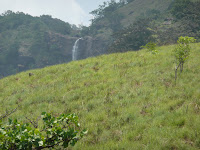
It was a steep upward journey along the ridge. Only consolation were the small bushes – little “oasislets” sheltering us temporarily from the merciless sun. In between, we got a glimpse of glittering Bandaje falls. The spectacular sight filled my mind with simultaneous joy and despair. Unambiguously we were on right track but the destination was sooooooo faaaaar away. We have to gain good altitude and then take a left turn to reach the top of the falls before we can call it a day. As we moved ahead, the magnificent falls went behind a veil of surrounding hills, that was not lifted until we reached the summit of the waterfall. Minutes passed into hours and we were hoping to rediscover the falls, much closer this time. With no sight or sound of waterfall, our hopes were turning into despondency. Finally we climbed to a point beyond which the hill took a rapid decent and the view below was blocked by thick forest cover. We started walking along the periphery looking for a suitable place to go down. At this point we almost lost track of our destination. We were hoping to see Bandaje falls to our left, but failed to realize that the ridge actually took us at least one k.m behind the summit. By this time our bottles were nearly empty and failing to reach the fall, the only source of water nearby, means serious trouble. What happened next was nothing short of a miracle. The guys at the head of our team saw two men with sharp weapons in hand coming towards us. Initially apprehensive, we were relived to know that they were from some adventure club of Bangalore. The two daredevils were Bandaje veterans, this being their third/fourth visit. They were out there to observe wild life at night and accordingly set up their tent near a small stream away from summit of the falls. They led us to the normal camping place for trekkers, very near to the tip of the Bandaje waterfall. While interacting, we came to know about bear attack on a group of trekkers a few days back. They also warned about leopards and snakes. The safety rules are simple – stay united and do not venture away from camping site after the dark. Interestingly, bears and leopards can be kept away by lighting a fire, but snakes are attracted due to warmth – a delightful privilege to choose one of them! After day long wear and tear, my mind was too numb to any such warnings. I just wanted to forget everything and rest in peace until tomorrow.

To be contd ............

Thursday, April 02, 2009

Bijapur-Badami-Aihole-Pattadakal

Team members : Ankur, Bota, Rajdip and Somnath
Photography : Rajdip and Bota

Travel info:
Bijapur is located ~550 Km. northwest of Bangalore. It served as the capital of Adil Shahi dynasty from 1500 to 1686. The city is connected to Bangalore both by rail (~17 hrs) and road (may take a couple of hours less, but nothing compared to the comfort of the train journey). The city is famous for many historical monuments built during Adil Sahi dynasty.
Badami was the capital of Badami Chalukyas (550 to 750 AD). Situated 128 Km south of Bijapur and famous for it's cave temples, Badami can be reached from Bijapur by road via either Bagalkot or Kerur. Aihole and Pattadakal is further 50 Km away from Badami and popular for rock cut temples. Avail local bus service from Badami or hire auto/taxi. There is no place for overnight stay at Aihole/Pattadakal but decent hotels are available at Badami. While coming back to Bangalore, you can take a bus to Gadag(~100 Km) and from there board the train (Hampi express, around 6 pm) to Bangalore.
I guess the best time to visit is from November to January. We went there in the middle of March and it was hot like hell.

We start from Bangalore (Day 1):
Basava express departed from Yesvantpur around 4 o'clock in the afternoon. There was hardly any catering service available during the journey. Anticipating this beforehand, we boarded the train with plenty of foods and drinking water. Soon we were out of the city limits and passing through a vast vacant rocky terrain, dotted with intermittent hills. In the fading light of the setting sun, the surroundings wore a beautiful look. A veil of darkness covered the surroundings soon. After playing cards for some time and having dinner, we retired rather early. Next day as the train left Gulbarga at the dawn, a little drama unfolded right before us. The compartment was almost empty by then, as most of the passengers got down at Gulbarga. A ticket collector got hold of three suspected snatchers. As usual there were no security personnel on board – they are as rare as water in the middle of a desert. All the three were very strongly build and they tried to prove their innocence for few moments. Then two of them ran away. Being cornered, the third one became aggressive and started abusing and threatening his captor with dire consequences. We were in a fix-what to do if the goon tries to assault the ticket collector. To our great relief, the train slowed down for some reason and the captive managed to break free and jump out of the train. We were too agitated to sleep further.

We reach Bijapur and hire a tonga for the day (Day 2):
Luck favoures the cautious! We managed to reach Bijapur safely and on time (9.30 morning). We were soon surrounded by auto wallahs and tonga wallahs, trying to impress us with tourist information booklets. Tonag was the automatic choice – travel in a nawabi style and of course it can accommodate four persons 100 times more comfortably than auto. A big surprise was due for us. Soon after coming out of the station complex, we were thrilled at the sight of Gol Gumbaz. With clear blue March sky at the background, it was a spectacular sight. The tonga wallah drove us to a hotel not too far from the gigantic monument and we checked in to refresh.

History in a nutshell:
From the middle of 14th century to the end of 15th century Hindu kingdom Vijaynagar and Bahamani sultanate were the two most powerful states of Decan. In the first quarter of 16th century, Bahamani sultanate broke up into Bijapur, Golkonda, Ahmednagar and Bidar, Bijapur being the most powerful. They were engaged in many battles among themselves and with Vijaynagar. In the year 1565 the sultans joined hands and defeated Vijaynagar in the battle of Talikota. In next 80 odd years Bijapur grew in size and prosperity, followed by cultural development. The downfall started with the revolt of Shivaji, whose father was the Maratha commander of Bijapur sultans. Severely weakened by Maratha attacks, Bijapur had to contend with Mughal invasions in the last quarter of century. Finally in the year 1686, Mughal armies under Aurangzeb conquered Bijapur.
Visit http://en.wikipedia.org/wiki/Bijapur_Sultanate for more information.

Bijapur – places of interest (in the order we visited):
Bijapur is famous for islamic architecture, mainly places of worship and mausoleums. Some of the buildings serve as government office at present. At it's pinnacle the city was protected by three great walls. You can still see the remains of them as you travel through the city. Other than the ticketed monuments-Gol Gumbaz and Ibrahim Rauza, most of the places are not well maintained. Interiors of the gigantic buildings were amazingly cool than compared to the scorching heat outside and this attracted scores of vagabonds to enjoy cool comfort free of cost.

Jumma masjidThe mosque, claimed to be the largest in south India (by the caretaker), was built by Ali Adil Shah in the year 1565. There are holy inscriptions from Quaran in gold on the wall of the mosque. But the place is not very well maintained and full of encroachers.

Chand Bawdi – a huge tank that served as water resource during the days of sultans. This was built during the reign of Ibrahim Adil Shah II (1580-1626).


Jod Gumbaz – A place of warship, consisting of twin structures as the name suggest. This is actually tomb of two noble men. Again very dirty and crowded place.

Ibrahim Rauza – This is a real beauty, constructed by Ibrahim Adil Shah II (1580-1626) as a mausoleum for his queen Taj Sultana. But the sultan was the first to die and was buried inside. His wife, sons and daughter followed later.

Malik-e-Maidan – A huge cannon, brought back from Ahmadnagar as a trophy of war. This giant had sealed the fate of many battles, including the famous one at Talikota (1565). It is said that the cannon remains cool even in scorching sun and sounds like a bell when tapped. But we could not feel it because ASI has barricaded the area after several ugly inscriptions of X loves Y on it's surface. Poor fellow – dreaded by enemy and protector of the city in many battles could not protect itself from the side effect of romance !

Upri buruj – This tall structure served as a watch tower safeguarding the capital. We got a nice panoramic view of the city from the top. There are two big cannons at the top.
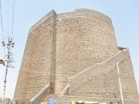
Barakaman – The incomplete mausoleum of Ali Adil Shah II. Started during the fag end of the Bijapur sultanate, the king died before the structure was complete.

Gol Gumbaz – The most famous monument of Bijapur. The gigantic dome is the tomb of Mohammed Adil Shah (1627-57). I have uploaded one picture (middle below) to give you a feeling of it's hugeness. The picture was take from the ground and the black dots are the people at the top! We took the narrow stairs to go all the way to the top. I really wonder how the sultans, presumably of big physique, managed to climb through such narrow staircase. There is a whispering gallery at the top and people were screaming like wild animals. Stand next to the small railings and look down – you can see the tombs, reduced to the size of the match boxes. It's a bit scary to stand near a small railing and look down from that height. Once outside, we got a fantastic view of the whole city from the top for the second time in a day. There is a small museum located in the building in front of the Gumbaz. There are several items, like sculptures, weapons of the old time, portraits of sultans, potteries, old maps of the city etc. I still vividly remember a chain made of stones! By the time we came out of Gol Gumbaz complex, it was almost evening and day 2 of our journey ended in a happy note.


Visit http://en.wikipedia.org/wiki/Bijapur,_Karnataka for more information.

Bijapur to Badami – the bumpy ride (Day 3) :
We started very early in the morning (~ 5.30 am). After reaching the bus stand, we found that there is no direct bus from Bijapur to Badami. We have to either go via Bagalkot or Kerur. A bus was about to depart for Kerur and we boarded it. It took some time for the bus to hit the highway. And then the hell broke loose. The highway was not very smooth all along. But it hardly bothered the driver. Rarely releasing the accelerator, he maintained the breakneck speed. Frequently he drove the bus down the bumpy ground beside the road to avoid speed breakers. With violent jerks, the bus moved ahead in a single piece! It was time for the sunrise and a very rare occasion in the life of city dwellers like me, who are late risers and hardly have the luxury to have an unobstructed vista up to the horizon. There were several sunflower plantations at both sides of the road. It is time for the flowers to wake up, open their eyes, face the Sun and say “hello and welcome” to a new day. After 3 hrs of ordeal we reached Kerur. A bus was leaving for Badami and we were into another mess (of different kind) in no time. It was a local country bus - packed with human, poultry, milk cans, sackful of grains, haystacks, bundle of clothes and miscellaneous. We managed to find some free space adjacent to the drivers cabin. It was roughly an hours journey through the country side. Gradually the landscape changed - roofed houses, sign boards advertising hotels, post office building – heralding our destination (to our delight!)

We reach Badami(Day 3) :
The trauma came to an end. Relived, we came out of bus stand and lodged in a hotel adjacent to the bus stand. By the time we were ready for the days trip, it was already 11 am. Quickly we gathered the following informations from the locals. Cave temples of Badami are situated at a walking distance from the bus stand. Reluctant to walk - take an auto/tonga. Pattadakkal is situated 25 Km away from Badami and Aihole is further 25 Km from Pattadakkal. You can either travel by local bus from Badami or hire an auto/taxi (more convenient). We decided to visit Aihole/Pattadakkal first, jostled into an auto and headed straight to our destination.

History in a nutshell:
Badami was the capital of Chalukyas (~550-750 AD), founded by Pualkesi I. Around 642 AD, for a brief period of 10 -12 years Pallavas captured it. Chalukyas soon delivered a fitting reply by not only driving Pallavas back, but also seizing their capital Kanchipuram. Later Badami fell into the hads of Rastrakutas (~750-975 AD). Chalukyas of Kalyani defeated them and ruled for next 200 years. They were followed by Hoysalas(~1200-1350 AD), Vijayanagar empire (~1350-1560 AD), Adil Sahis (~1560-1686 AD), Marathas and Hyder Ali before falling into the hands of the British. Badami along with Aihole and Pattadakkal are famous for cave temples and rock cut temples built by Chalukyas mostly during 6th to 8th century AD.

“Aihole is considered a School of Architecture, Badami a Degree College, and The University of architecture is Pattadakal.” - Wikipedia

Visit http://en.wikipedia.org/wiki/Badami for more information.

To be contd ..................

Wednesday, March 11, 2009

Maklidurg (Makalidurga!) Trek

Situated 60 km away from Bangalore, Maklidurg is a nice location for one day trekking(moderate). The easiest way to reach there is by train(Guntur passenger from Yesvantpur Jn. at 8.15 am and the train back to Bangalore starts from Maklidurg around 3.30 pm). You can also travel by road and reach Maklidurg via Doddaballapur. Carry sufficient food and plenty of water.

Maklidurg is a tiny but tranquil railway station without any mad rush - not a single hawker, not a single porter, not a single beggar and all other craps that drive you crazy in any big Indian railway stations. As soon we got down from the train, we were welcomed by monkeys. If you do not tempt them by showing the food items you are carrying with, these creatures are quite harmless in general. We followed the railway track for another kilometer or so and reached a temple at the base of the hill. This place is not as famous as Skandagiri with trekkers, but still finding the way up in broad daylight should not be very difficult. Moreover, there are some yellowish arrows marked on the stones to help you. Once you find them, the rest is pretty straightforward. We started ascending with intermittent reposes and the whole thing went quiet eventless. After two tiring hours we were standing jubilantly on a dilapidated fort wall - mission accomplished :o) The landscape is dotted with several other hills, including Nandi Hill and Skandagiri, which we managed to identify! You can see a big lake not too far away from the foot of the hill (it seems from the top), the railway track lying like a giant metallic serpent and the moving trains remind you of your childhood toys. Everything looks so small from the top!

We spent some time exploring the top, which is a fairly large plane area protected by fort wall from all the sides and a temple of lord shiva roughly at the middle. We later came to know that twice a year devotees come to the temple to offer prayer. We rested our weary legs, took photos, consumed food and drinks and were ready for descending in an hour and half. And suddenly a queer idea struck our mind – lets try out some other route rather than walking down tried and tested one! This is a perfect example of what one should not do in a hot day with depleting stock of water. After an hour or so the track we followed suddenly disappeared and a very steep slope were lying ahead. All of us were very reluctant to go all the way up and take the right track. Stranded and desperately looking for some way that can take us all the way down, few of us scattered in different directions searching for it. After a brief survey, Soupi came up with an outrageous plan! He suggested that if we can manage to climb down around 50 mt, all along one branch of tree to another, we are out of the hell (heavenwards if we slip). We were prompt to vehemently oppose the proposed acrobatic adventure and after few more despairing moments, sense of practicality enlightened our mind (at last) - we decided to go all the way up in search of the good old route. It took a while (and a lot of energy) to find the right track and we totally ran out of water by then. Our voices gradually fell silent - no chitchats, no jokes; just the sound of footsteps going down. Battling extreme heat and dehydration for another hour, we somehow managed to trudge all the way back to the temple at the base of the hill. A few people were around and they offered us water (read life) to drink. No comments about the hygiene but the poor fellows drink this day after day for survival and so did we. The return train was gone by then and we took a bus to Doddaballapur and from there to Bangalore.
Team members: Anshu, Ankur, Bota, Pratap, Titas, Sukrit, Soupi, Somnath

Photographs taken by Anshu


Belur-Halebidu


Belur and Halebidu served as the capital of Hoysala empire, which ruled modern day Karnataka and part of Tamilnadu from 10th to the middle of 14th century. It is located at Hassan district in Karnataka, at a distance of 220 km from Bangalore. The ideal way to visit the place is to take KSTDC conducted tour, which covers Belur, Halebidu and Sravanabelagola. Otherwise the place is well connected to Bangalore by bus and train. There is regular train service between Bangalore and Arsikere. Belur and Halebidu is within 50 km of Arsikere. You can take a bus or hire a car from Arsikere. But you miss Sravanabelagola, which is 80 km away and in opposite direction. For return journey, you can take Jansatabdhi express from Arsikere at 6.30 pm. Being well developed tourist spots, availability of food and drink is not a problem here.

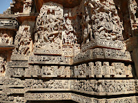
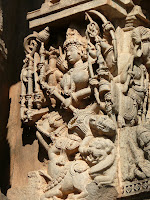
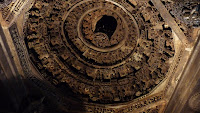
We took Chalukya express from Yesvantpur at 6.30 in the morning and reached Arsikere in two and half hours. The bus for Halebidu was to start around 11. So we (five of us) decided to hire a car(@700). Our first destination was Halebidu. The road was reasonably good, albeit narrow. The Hoysaleswara temple in Halebidu is dedicated to lord Shiva and was built in the 12th century. Inside the temple there is a big, dark but refreshingly cool hall, supported by decorated pillars. The Shiva linga is situated in a well lit room. But the real beauty of the temple lies in it's outside walls. There are numerous sculptures carved to minute details – mythological stories, Ramayana, Mahabharata etc. More astonishing – there is hardly any space left untouched by the sculptors. The only sad thing was, being weekend, there was too much crowd. Some shooting was going on inside, which added to our woes. But overall, it was a great experience. For nature lovers, there is a huge lake adjacent to the temple complex.

Our next destination was Chennakesava temple in Belur, 20

km away form Halebidu. This temple is dedicated to lord Vishnu.
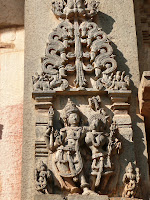
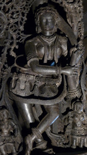
This is actually a temple complex, where several temples were built over a period of time. The central one is Chennakesava temple. The hall inside, supported by decorated pillars, is dark. But there are guides with light to enlighten you at a nominal price. The main attraction inside are four sculptures of Shilabalika in various poses (“Beauty with the mirror”, “The lady with the parrot” etc). The outside walls are again full of minutely carved magnificent sculptures depicting the Hindu epics. Look for the statue of the man fighting the tiger. This was the symbol of Hoysala empire.

For more details:
http://en.wikipedia.org/wiki/Belur and http://en.wikipedia.org/wiki/Halebidu

Team members: Ankur, Bratin, Rajdip, Supratim and Somnath

Photographs taken by: Bratin and Rajdip

Halebidu:


Belur: